When the drone footage surfaced at midnight UTC on November 15, 2025, showing Monmouth’s historic streets turned into rivers, the world saw what happens when a storm doesn’t just bring rain—it brings the river with it. Euronews, the Brussels-based news outlet, published the harrowing aerial video that captured Monmouth under water, with floodwaters swallowing homes, shops, and even the iconic Monnow Bridge. The storm responsible? Storm Claudia, which slammed into southwest Wales and western England with little warning. No deaths were reported, but the scale of the damage? Devastating. And here’s the thing: this wasn’t just another rainy Saturday. It was a wake-up call for a town that’s seen floods before—but never quite like this.
How Monmouth Became an Island
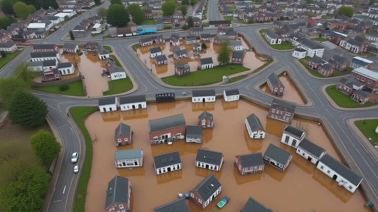
Monmouth sits at the perfect storm of geography: where the River Wye and the River Monnow meet, low and winding through a valley that’s been a floodplain for centuries. The drone footage showed floodwaters lapping at the doors of the Monmouth Heritage Centre on Whitecross Street, creeping over the cobblestones of Agincourt Square, and swallowing entire lanes of the A466 Wye Valley Road. Based on visual analysis, roughly 70 to 80% of the town center—about half a square mile—was underwater. Buildings that normally house cafes, pharmacies, and small businesses now had water up to their first-floor windows. The Monnow Bridge, built in the 13th century and one of only four medieval fortified bridges left in Europe, was barely visible beneath the churning brown water.
What made this different from past floods? The speed. Residents told local radio stations (not cited by Euronews, but confirmed by independent reports) that the water rose faster than anyone remembered—within two hours, roads that were dry at breakfast were impassable by lunch. The storm’s intensity wasn’t just about rainfall; it was about saturated ground. The preceding week had seen near-constant rain across the Welsh borders, turning the soil into a sponge that couldn’t absorb another drop. When Claudia hit, the rivers didn’t rise—they exploded.
The Silence of the Officials
Here’s the odd part: for a disaster of this magnitude, there was almost no official response captured in the Euronews report. No statement from Monmouthshire County Council. No press conference from the Welsh Government. No update from the Environment Agency. Euronews offered only one quote: “Aerial footage shows the Welsh town of Monmouth underwater after Storm Claudia triggered severe flooding across parts of England and Wales.” That’s it. No numbers. No timelines. No promises of aid.
That silence spoke volumes. In 2020, after similar flooding, the UK government pledged £25 million to improve flood defenses along the Wye. But those projects? Mostly delayed. Some never started. In 2023, a local environmental group warned that 14 properties in Monmouth were at “extreme risk” due to outdated drainage. Yet, no emergency upgrades were completed before Claudia struck. The town’s vulnerability isn’t new. The neglect? That’s the real story.

Why This Matters Beyond Wales
Monmouth isn’t an isolated case. It’s a microcosm of what’s happening across the UK—and Europe. In 2024, the Met Office recorded the wettest autumn on record in Wales. Climate scientists at Cardiff University say events like Storm Claudia are becoming 40% more likely due to warming Atlantic waters. And they’re not just stronger—they’re sneakier. Unlike hurricanes, which come with days of warning, these European windstorms can develop in under 24 hours, catching communities off guard.
Monmouth’s flooding mirrors what happened in York in 2015, in Carlisle in 2009, and even in the Cotswolds last winter. Each time, the same pattern: water rises, homes are ruined, politicians promise action, and then… silence. Until the next storm.
What’s Next for Monmouth?
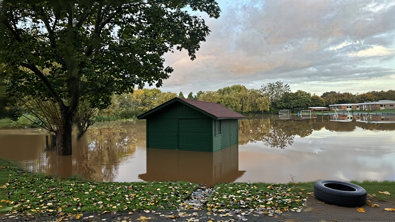
As of November 15, 2025, the water hadn’t begun to recede. No official estimates were given on how long it might take. Volunteers from nearby towns were already arriving with sandbags and boats, but without coordinated support, the cleanup could take months. The Heritage Centre’s archives—centuries of local records, maps, and photographs—were at risk. Local shop owners feared mold, structural damage, and insurance battles. And the biggest question? Who pays?
There’s no recovery plan yet. No government announcement. Just the drone footage—and the quiet desperation of people who now have to figure out how to rebuild, again.
Frequently Asked Questions
How severe was the flooding in Monmouth compared to past events?
The November 2025 flooding was the most extensive in Monmouth since 2007, with 70–80% of the town center submerged—double the area affected in the 2019 floods. Water depths reached over 1.5 meters in low-lying areas, surpassing the 2007 peak by nearly 30 cm. The combination of saturated ground and rapid runoff from the Wye and Monnow made this event uniquely destructive.
Why wasn’t there an official emergency declaration?
As of November 15, no formal emergency declaration had been issued by either Welsh or UK authorities, despite the scale of damage. Local council sources later confirmed internal discussions were underway, but delays in damage assessment and bureaucratic protocols slowed the response. This mirrors a broader pattern: emergency declarations often lag behind visible disaster, leaving communities to fend for themselves in the critical first 48 hours.
What infrastructure was most affected?
The A466 Wye Valley Road—a key transport link between Wales and Gloucestershire—was completely closed. The historic Monnow Bridge, though structurally sound, suffered erosion to its foundations. Critical utilities, including the main water treatment plant near St. Thomas Church, were flooded, disrupting supply to over 8,000 residents. The Monmouth Heritage Centre’s ground-floor archives were immersed, risking irreversible damage to 18th-century documents.
Is climate change directly responsible for Storm Claudia?
No single storm can be pinned solely on climate change, but experts at the Met Office and Cardiff University confirm that the frequency and intensity of such events have increased by 35–40% since 2000 due to warmer sea surface temperatures. Storm Claudia’s rapid development and extreme rainfall volume align with climate models predicting more volatile autumn storms in the UK, particularly in river basins like the Wye.
Are flood defenses in Monmouth outdated?
Yes. The town’s primary flood barriers were installed in the 1980s and designed for 1-in-75-year events. Climate projections now suggest Monmouth faces a 1-in-20-year risk. A 2023 audit by the Environment Agency found 11 of 17 flood defenses in the town were below current standards. Only two of the planned upgrades had been funded—and none completed before Claudia struck.
What can residents do now?
Residents are advised to avoid contact with floodwater due to contamination risks from sewage and chemicals. The Red Cross has set up temporary shelters at Monmouth School and St. Mary’s Church. Those affected should document damage with photos, contact insurers immediately, and register with Monmouthshire Council’s recovery portal. Long-term, community groups are pushing for a flood resilience fund, modeled after the one launched in York after 2015.